In Brisbane, the complex geology of the Brisbane Tuff and Neranleigh-Fernvale beds creates sharp lateral variability. You often find sound rock at 5 m directly adjacent to 20 m of residual clay. That unpredictability makes geotechnical instrumentation essential for verifying design assumptions. We design and install inclinometers, piezometers, and settlement arrays tailored to each site's specific ground conditions. Before finalizing the monitoring layout, we typically correlate data with ensayo SPT profiles to validate stratigraphic boundaries. The goal is to capture real-time behavior of the ground under construction loads. That means selecting the right sensor type, depth, and reading frequency from the start. Instrumentation is not an afterthought, it is a core design tool.
Geotechnical instrumentation transforms subsurface uncertainty into quantifiable data, allowing engineers to verify designs during construction rather than after failure.
Scope of work
The contrast between the inner-north suburbs like Bowen Hills and the southside at Mount Gravatt illustrates the challenge. Bowen Hills sits on deep alluvium where piezometers must be installed in multiple aquifers to track pore pressure dissipation. Mount Gravatt, by contrast, is underlain by residual soil over fresh volcanic rock, so inclinometers are needed to monitor cut slope movements during the wet season. Each installation follows AS 1726 and AS 4678 requirements for borehole backfill, seal integrity, and surface protection. Our team uses vibrating-wire piezometers for long-term stability and in-place inclinometers for continuous profile logging. All sensors are calibrated against NATA-traceable standards before deployment. We also install automated data loggers with remote telemetry so the project engineer can review readings daily. That level of detail prevents surprises during excavation or fill placement.
Technical reference image — Brisbane
Area-specific notes
The main risk in Brisbane is installing instruments that do not survive the construction cycle. Heavy earthmoving equipment, deep trenching, and high groundwater can shear cables or flood casings. We protect every installation with lockable surface boxes, armoured cable, and sacrificial conduits at crossing points. Another common issue is sensor drift in the reactive clay profiles west of the city. That is why we specify vibrating-wire sensors with built-in temperature compensation and schedule monthly field checks against manual readings. Missing early warning signs from a failing inclinometer can lead to slope failure or structural damage. The cost of re-drilling a lost borehole far exceeds the cost of proper protection the first time.
Biaxial inclinometer casings installed in boreholes to depths of 40 m. Manual or automated readings provide lateral displacement profiles. Used extensively in cut slopes along the Gateway Motorway corridors.
02
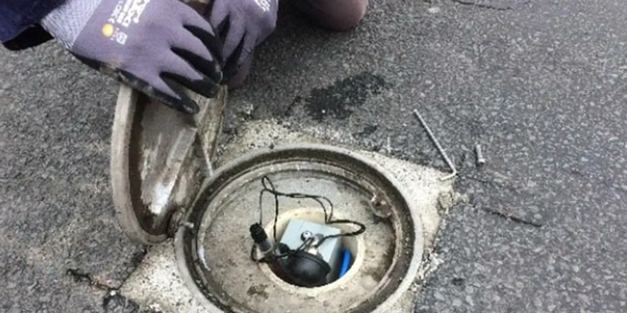
Piezometer Installations for Groundwater Control
Vibrating-wire and standpipe piezometers placed in discrete aquifers. Real-time pore pressure data supports dewatering design and stability analysis. Common in basement excavations in the CBD.
03
Settlement and Heave Arrays
Surface and subsurface monitoring points, including settlement plates, extensometers, and magnetic rings. Track fill settlement and foundation heave with sub-millimetre precision.
04
Automated Data Logging and Telemetry
Remote monitoring systems with cloud-based data access. Alerts are triggered when predefined thresholds are exceeded. Ideal for long-term post-construction monitoring of embankments and retaining walls.
Standards used
AS 1726:2017 — Geotechnical Site Investigations, AS 4678:2002 — Earth Retaining Structures, AS 1289 — Standard Guide for Monitoring Slope Movements, NATA ISO/IEC 17025 — Laboratory and Field Calibration
Frequently asked questions
What types of geotechnical instrumentation are most common in Brisbane projects?
The most frequently used systems are inclinometers for slope movement, vibrating-wire piezometers for pore pressure, and settlement plates for vertical displacement. Brisbane's variable geology often requires a combination of these to capture both lateral and vertical ground response during construction.
How long do geotechnical instruments typically remain in place?
Most instruments stay active for the duration of construction plus a post-construction monitoring period of 6 to 24 months. Inclinometers and piezometers in critical slopes or retaining walls may remain operational for 5 years or longer if the asset requires ongoing surveillance.
What is the typical cost range for a geotechnical instrumentation program in Brisbane?
A comprehensive program for a mid-size excavation or slope can range from AU$4,040 to AU$7,390 depending on sensor count, borehole depth, and telemetry requirements. This includes installation, initial calibration, and 12 months of data collection.
How do you ensure instrument readings are accurate and reliable?
The reference range for this service in Brisbane is AU$4.040 - AU$7.390. The final price depends on the project scope and volume.