Brisbane's urban expansion over the past two decades, particularly in the inner-northern suburbs and along the Brisbane River corridor, has brought new challenges for geotechnical engineers. The city sits on a complex sequence of Triassic to Jurassic sedimentary rocks (the Brisbane Tuff and sandstones) overlain by variable Quaternary alluvium and colluvium. Understanding the dynamic soil response in this setting often requires passive seismic techniques. We apply the HVSR microtremor survey (Nakamura method) to map the fundamental resonance frequency of soil columns, a parameter critical for evaluating seismic site effects under AS 1170.4. This non-invasive method complements borehole data and helps define site class across large areas without mobilising heavy drilling equipment.
The HVSR microtremor survey (Nakamura method) identifies the fundamental resonance frequency of soil columns, a critical parameter for seismic site classification in Brisbane's variable geology.
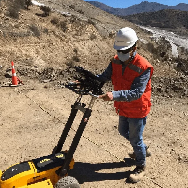
Scope of work
In Brisbane, we frequently observe that shallow bedrock (5–15 m below surface in parts of Spring Hill and Fortitude Valley) creates sharp impedance contrasts that amplify ground motion at specific frequencies. The HVSR microtremor survey (Nakamura method) captures this precisely by recording ambient vibrations for 20–40 minutes per station. We deploy three-component seismometers along profiles and process the horizontal-to-vertical spectral ratio to identify the fundamental peak. When combined with a MASW-Vs30 survey, we can estimate the average shear-wave velocity to 30 m depth, fulfilling the NEHRP site classification requirements for Brisbane's seismic design codes. The method works well even in dense urban areas where active sources are impractical.
Technical reference image — Brisbane
Area-specific notes
AS 1170.4 classifies seismic actions based on site sub-soil class (Ae to Ee), and Brisbane's alluvial deposits along the river can fall into class Ce or De. A fundamental resonance frequency below 1 Hz indicates deep, soft sediments prone to amplification. Without an HVSR microtremor survey (Nakamura method), engineers risk underestimating the design response spectrum for buildings over 4 storeys on these deposits. The method also helps identify 2D resonance effects in narrow valleys like those in the western suburbs, where conventional boreholes alone may miss lateral soil variability. We integrate these results with local borehole logs to produce reliable site response models.
H/V spectral ratio after Nakamura (1989) with STA/LTA windowing
Deliverable
Resonance frequency map, site class per AS 1170.4 and NEHRP
Linked services
01
Single-station HVSR surveys for site class
Rapid assessment of fundamental resonance frequency and site class per AS 1170.4 using a single three-component seismometer. Ideal for preliminary seismic screening of large development sites or for verifying borehole-based site class assignments. We deliver H/V spectral ratio curves and interpreted resonance peaks.
02
Multi-station HVSR array for 2D profiling
Deployment of 8 to 16 stations along a transect to map lateral variations in soil resonance frequency and thickness. Suitable for linear infrastructure projects (bridges, tunnels) and for assessing basin-edge effects in Brisbane's river valleys. Combined with MASW-Vs30 for integrated shear-wave velocity models.
Standards used
AS 1170.4:2007 Earthquake actions (site class determination), NEHRP Recommended Provisions (FEMA P-750) – Vs30 site classification, SESAME (2004) Guidelines for the implementation of the H/V spectral ratio technique on ambient vibrations
Frequently asked questions
What is the HVSR microtremor survey (Nakamura method) and how does it work?
It is a passive seismic technique that records ambient ground vibrations (microtremors) using a three-component seismometer. The horizontal-to-vertical spectral ratio (H/V) isolates the fundamental resonance frequency of the soil column. This frequency relates directly to the thickness and stiffness of the overburden, enabling site class estimation per AS 1170.4 without drilling.
How much does an HVSR microtremor survey (Nakamura method) cost in Brisbane?
For a typical single-station survey covering 5–10 points in a residential development, the cost ranges between AU$2,450 and AU$4,280 depending on site access, number of stations, and reporting requirements. Multi-station arrays for linear infrastructure are quoted separately based on profile length.
Can the HVSR method replace boreholes for seismic site classification?
No. The HVSR microtremor survey (Nakamura method) provides complementary information on dynamic soil response, but it does not replace boreholes for stratigraphic logging, groundwater sampling, or laboratory strength tests. We recommend combining HVSR with at least one borehole per site class zone to calibrate the resonance-to-depth relationship.
What is the typical depth of investigation for the HVSR method in Brisbane's geology?
The depth of investigation depends on the fundamental resonance frequency. In Brisbane's alluvial deposits (f0 = 0.5–2 Hz), the method typically senses 20–80 m of soil column. On shallow rock sites (f0 > 5 Hz), the effective depth reduces to 5–15 m. The method is most reliable where the impedance contrast between soil and bedrock exceeds a factor of 2–3.